


Collection: Esri Press
Our mission is to inform, inspire, and teach professionals, students, educators, and the public about geographic information system (GIS) technology by developing print and digital publications. Our goal is to increase the adoption of ArcGIS and support the vision of Esri. We strive to be the leader in publishing great GIS books and we are dedicated to improving the work and lives of our global community of users, authors, and colleagues.

-


Designing Better Maps
Learn from the best to create successful maps using any GIS or illustration product with Designing Better Maps: A Guide for GIS Users, third edition, written by an expert cartographer.
Regular price $84.99Regular price $84.99 Sale price $84.99Unit price per -


Python Scripting for ArcGIS Pro
Python Scripting for ArcGIS Pro is the definitive, easy-to-follow guide to writing Python code with spatial data in ArcGIS Pro, whether you’re new to programming or not.
Regular price $95.99Regular price $95.99 Sale price $95.99Unit price per -


Security First
Security First: Geospatial Workflows for a Safe and Equitable World shows readers how to use geospatial tools and data to analyze complex issues.
Regular price $89.99Regular price $89.99 Sale price $89.99Unit price per -


The Geography of Hope
From Prague to Berkeley to Nairobi to Kyiv, The Geography of Hope tells the stories of optimists who map the world and make it a better place.
Regular price $39.99Regular price $39.99 Sale price $39.99Unit price per -


Lining Up Data in ArcGIS
Lining Up Data in ArcGIS: A Guide to Map Projections is an easy-to-navigate, troubleshooting reference for any GIS user with the common problem of data misalignment. Completely updated with full-color maps and diagrams from ArcGIS Desktop 10.6 but still compatible with ArcGIS Desktop 10.1 and hig...
Read MoreRegular price $47.99Regular price $47.99 Sale price $47.99Unit price per -


Map Use
Learn the most critical concepts for map comprehension and creation with an updated, focused edition of Map Use: Map Reading and Design, Volume 1, ninth edition.
Regular price $95.99Regular price $0.00 Sale price $95.99Unit price per -


Top 20 Essential Skills for Imagery and Remote Sensing
Top 20 Essential Skills for Imagery and Remote Sensing guides readers step-by-step through interpreting imagery, creating imagery products, and performing various imagery analysis workflows.
Regular price $79.99Regular price $79.99 Sale price $79.99Unit price per -


Getting to Know Web GIS
Get the latest information about online GIS using ArcGIS® apps and functionality with Getting to Know Web GIS, fifth edition.
Regular price $129.99Regular price $0.00 Sale price $129.99Unit price per -


Mapping with Altitude
Use Mapping with Altitude: Designing 3D Maps to deliver clear, compelling cartographic representations in 3D that are both eye-catching and informative.
Regular price $84.99Regular price $84.99 Sale price $84.99Unit price per -
Valuing Place and Purpose
Valuing Place and Purpose: GIS for Land Administration shows how GIS is used to visualize, analyze, and administer land and property information, define acceptable use, conserve vulnerable landscapes, and protect disadvantaged communities and indigenous people.
Regular price $23.99Regular price $23.99 Sale price $23.99Unit price per -


The Esri Guide to GIS Analysis, Volume 1
The Esri Guide to GIS Analysis, Volume 1, second edition, updates a classic text that lays the foundation for all GIS users to find spatial patterns, relationships, and trends that lead to better decision-making.
Regular price $59.99Regular price $59.99 Sale price $59.99Unit price per -


Geospatial Nations
Geospatial Nations: Building Essential Infrastructure for Modern Governments reframes geospatial capability as one of the essential foundations of modern governance.
Regular price $49.99Regular price $0.00 Sale price $49.99Unit price per -


Getting to Know Web GIS
Discover the power of modern Web GIS in Getting to Know Web GIS, sixth edition, including various updates in the ArcGIS ecosystem and new technologies and capabilities such as geospatial AI.
Regular price $199.99Regular price $0.00 Sale price $199.99Unit price per -


The Modern Planner
Written by Esri planning experts for planning professionals, The Modern Planner explains how GIS can modernize planning practices and improve community outcomes.
Regular price $59.99Regular price $0.00 Sale price $59.99Unit price per -


Leading with Data
Leading with Data: A Police Commander’s Guide to GIS and Crime Analysis shows the power of analysis to lead effectively with data-driven solutions and ensure public safety.
Regular price $79.99Regular price $0.00 Sale price $79.99Unit price per -

Geowater
Geowater blends technical innovation with deeply human stories, for readers to understand, model, and manage one of Earth’s primary resources: water.
Regular price $89.99Regular price $0.00 Sale price $89.99Unit price per -


Parcels
Parcels: How Property Shapes Geography is a clear‑eyed exploration of the land parcel and demonstrates how it serves as the critical link between people, data, and place.
Regular price $54.99Regular price $0.00 Sale price $54.99Unit price per -


Top 20 Essential Skills for ArcGIS Online
Explore the endless possibilities of interactive web mapping with Top 20 Essential Skills for ArcGIS Online.
Regular price $94.99Regular price $0.00 Sale price $94.99Unit price per -


Top 20 Essential Skills for ArcGIS Pro
Top 20 Essential Skills for ArcGIS® Pro introduces the most important skills so you can get up and running with geographic information systems (GIS).
Regular price $94.99Regular price $0.00 Sale price $94.99Unit price per -


Top 20 Essential Skills for ArcGIS Business Analyst
Top 20 Essential Skills for ArcGIS Business Analyst guides readers through fundamental and advanced workflows in both the web app and extension using 20 focused tutorials.
Regular price $99.99Regular price $0.00 Sale price $99.99Unit price per -

Women and GIS
Women greatly enrich science, leading research and directing decisions across myriad applications. Women and GIS: Mapping Their Stories reveals how ordinary girls become extraordinary women, overcoming obstacles to make significant global contributions.
Regular price $17.99Regular price $0.00 Sale price $17.99Unit price per -


The Spatial Edge
Bring your campus together academically and operationally with The Spatial Edge: The Strategic Advantage of GIS Skills Across Higher Education.
Regular price $39.99Regular price $0.00 Sale price $39.99Unit price per -
Prepare, Respond, Renew
Prepare, Respond, Renew: GIS for Wildland Fire explores a collection of real-life stories about wildland fire agencies successfully using GIS for preparedness, mitigation, response, and recovery and rehabilitation workflows.
Regular price $23.99Regular price $23.99 Sale price $23.99Unit price per -
Mapping the Nation
An annual compilation of inspiring stories of government GIS work, Mapping the Nation: Navigating Complex Challenges focuses on how organizations are addressing challenges in their industry.
Regular price $23.99Regular price $23.99 Sale price $23.99Unit price per -


GIS Jump Start for Health Professionals
Now, more than ever, professionals can benefit from the power of location data, maps, and analytics in healthcare with this concise and focused workbook.
Regular price $47.99Regular price $47.99 Sale price $47.99Unit price per -


Local Voices, Local Choices
Local Voices, Local Choices: The Tacare Approach to Community-Led Conservation chronicles the stories behind Jane Goodall’s holistic approach to conservation in Africa.
Regular price $36.99Regular price $0.00 Sale price $36.99Unit price per -
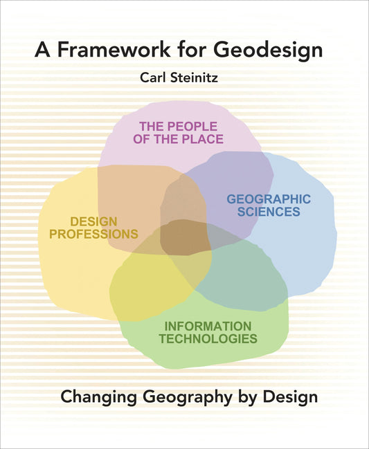
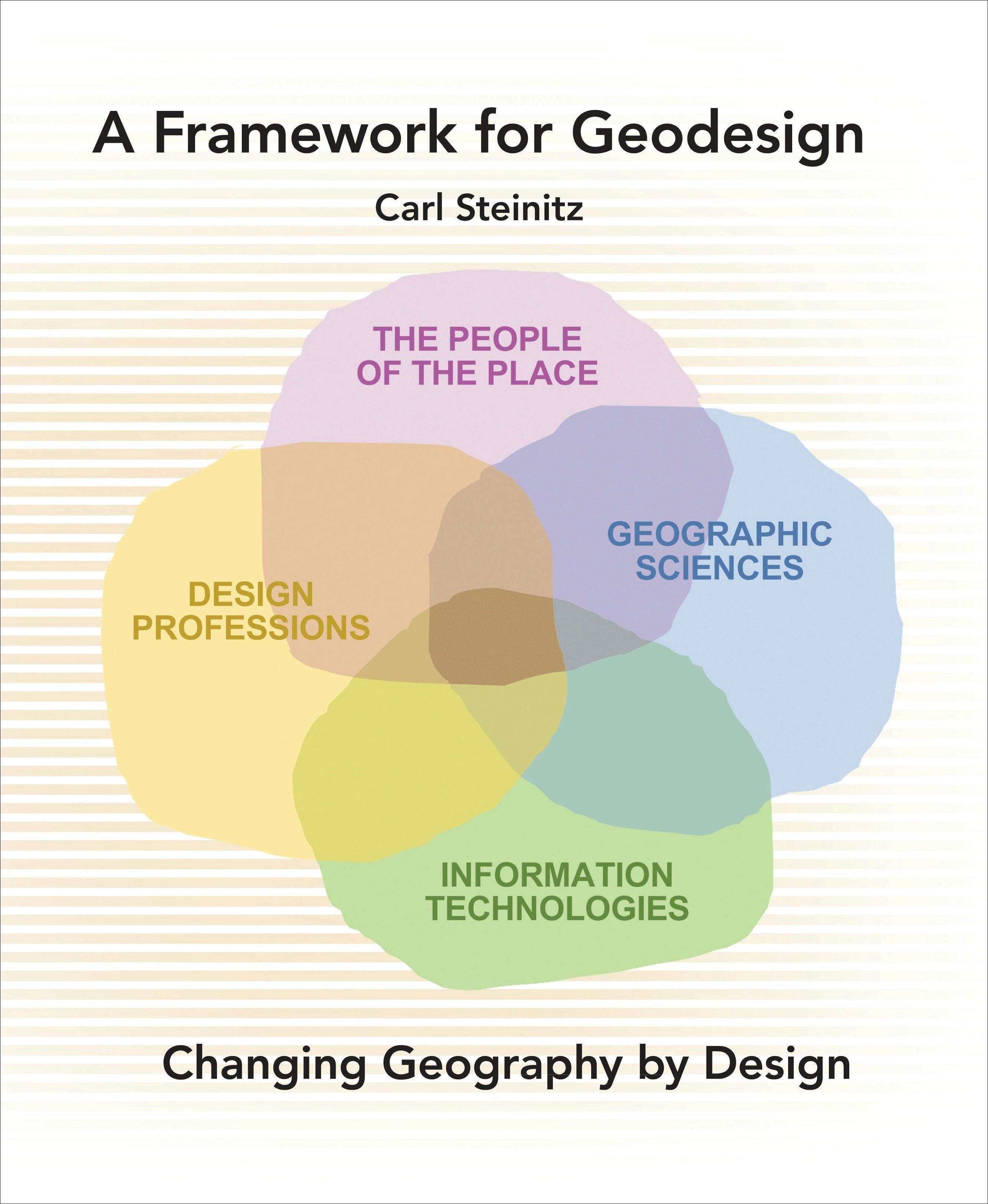
A Framework for Geodesign
A Framework for Geodesign: Changing Geography by Design presents the key concepts, history, and methodology of geodesign. As an idea, geodesign has the potential to enable more effective and symbiotic collaboration among the several design professions, geographically-oriented sciences, informatio...
Read MoreRegular price $95.99Regular price $95.99 Sale price $95.99Unit price per -
Mapping America's National Parks
Go behind the scenes at the National Park Service to see how maps are used to manage and sustain our national parks in Mapping America’s National Parks: Preserving Our Natural and Cultural Treasures.
Regular price $39.99Regular price $39.99 Sale price $39.99Unit price per -
GIS and Cartographic Modeling
GIS and Cartographic Modeling is a foundational work in the field of geographic information systems (GIS). An introduction to the concepts, conventions, and capabilities of map algebra as a general language, this book describes the analytical use of raster-based GIS.
Regular price $71.99Regular price $71.99 Sale price $71.99Unit price per -


Delivering Water and Power
Discover how GIS and location intelligence modernize utility infrastructure and operations for improved service delivery and management in Delivering Water and Power: GIS for Utilities.
Regular price $23.99Regular price $23.99 Sale price $23.99Unit price per -


Preserving Our Planet
Preserving Our Planet: GIS for Conservation explores real-life stories about conservation organizations successfully using GIS to meet challenges to biodiversity preservation.
Regular price $23.99Regular price $0.00 Sale price $23.99Unit price per -


GIS for Science, Volume 3
GIS for Science, Volume 3: Maps for Saving the Planet, highlights real-world examples of scientists creating maps about saving life on Earth and preserving biodiversity.
Regular price $47.99Regular price $47.99 Sale price $47.99Unit price per -


Smarter Government Workbook
Smarter Government Workbook: A 14-Week Implementation Guide to Governing for Results distills the lessons from Smarter Government into a 14-week plan to achieve strategic performance management.
Regular price $18.99Regular price $0.00 Sale price $18.99Unit price per -


A to Z GIS
Newly updated and expanded, A to Z GIS: An Illustrated Dictionary of Geographic Information Systems (GIS) is a comprehensive reference for anyone discovering the interdisciplinary nature of GIS.
Regular price $59.99Regular price $59.99 Sale price $59.99Unit price per -


Python Scripting for ArcGIS Pro
Unlock the power of Python in ArcGIS Pro with Python Scripting for ArcGIS Pro, the definitive, easy-to-follow guide to writing Python code with spatial data in ArcGIS Pro.
Regular price $159.99Regular price $159.99 Sale price $159.99Unit price per -


Protecting the People
Protecting the People: GIS for Law Enforcement explores a collection of real-life stories about law enforcement agencies successfully using GIS for crime analysis, open policing, and field mobility.
Regular price $23.99Regular price $0.00 Sale price $23.99Unit price per -


Resilient Communities across Geographies
A hybrid of theory and action, Resilient Communities across Geographies uses case studies to examine how global communities use GIS analysis, local knowledge, and engagement to realize resilience.
Regular price $41.99Regular price $49.99 Sale price $41.99Unit price per -


Top 20 Essential Skills for ArcGIS Utility Network
Learn how to use ArcGIS Utility Network, the powerful software that handles the complexity of modern utility systems now and into the future.
Regular price $79.99Regular price $79.99 Sale price $79.99Unit price per -


Protecting the Places We Love
Protecting special places that are in danger of being lost forever requires urgent action. It’s time for bold conservation strategies to accelerate land protection around the world.
Regular price $29.99Regular price $29.99 Sale price $29.99Unit price per -


Getting to Know ArcGIS Enterprise
The first book from Esri Press about ArcGIS Enterprise, one of Esri’s most important technologies for keeping your organization agile, collaborative, and responsive.
Regular price $159.99Regular price $159.99 Sale price $159.99Unit price per -


El negocio espacial
En El negocio espacial: competir y liderar con análisis de ubicación se proporciona una hoja de ruta para aprovechar el potencial de los datos geoespaciales en la cadena de valor de ubicación por medio de varios ejemplos del mundo real.
Regular price $107.99Regular price $107.99 Sale price $107.99Unit price per -


Mapping Community Health
Mapping Community Health: GIS for Health and Human Services explores a collection of real-life case studies about using geographic information system (GIS) technology to help build communities that improve health outcomes and increase accessibility to health care. The book also includes a “next s...
Read MoreRegular price $23.99Regular price $23.99 Sale price $23.99Unit price per -


Keeping People Safe
Keeping People Safe: GIS for Public Safety explores how emergency management, law enforcement, fire, rescue, emergency medical services, and homeland security agencies use geographic information system (GIS) technology to mitigate the effects of threats and hazards in their communities. The book ...
Read MoreRegular price $23.99Regular price $23.99 Sale price $23.99Unit price per -


The Esri Guide to GIS Analysis, Volume 2
See why you don't need to understand complex mathematical theories to apply statistical tools in your GIS projects in The Esri Guide to GIS Analysis, Volume 2: Spatial Measurements and Statistics.
Regular price $94.99Regular price $94.99 Sale price $94.99Unit price per -


Addressing Earth's Challenges
Addressing Earth’s Challenges: GIS for Earth Sciences explores a collection of real-life stories about how earth science organizations successfully use GIS to visualize and analyze data.
Regular price $23.99Regular price $23.99 Sale price $23.99Unit price per -


GIS for Science, Volume 2
GIS for Science, Volume 2: Applying Mapping and Spatial Analytics shows readers how scientists working on the world's most pressing problems apply geographic information systems—GIS.
Regular price $47.99Regular price $0.00 Sale price $47.99Unit price per -


Learning from COVID-19
Learning from COVID-19: GIS for Pandemics explores a collection of real-life case studies about how organizations across the globe have successfully used GIS to respond to the COVID-19 pandemic.
Regular price $23.99Regular price $23.99 Sale price $23.99Unit price per -


The ArcGIS Book
The ArcGIS Book: 10 Big Ideas about Applying The Science of Where and its companion website provide the ways that GIS technology can unlock your data to reveal deeper insights and a better understanding of virtually any problem with a geographic dimension.
Regular price $23.99Regular price $23.99 Sale price $23.99Unit price per -


Imagery and GIS
Imagery and GIS: Best Practices for Extracting Information from Imagery shows how imagery can be integrated successfully into GIS maps and analysis.
Regular price $119.99Regular price $119.99 Sale price $119.99Unit price per -


Spatial Statistics Illustrated
With approachable explanations and uncomplicated drawings, Spatial Statistics Illustrated gives readers an accessible understanding of some of the most widely used spatial statistics methods.
Regular price $69.99Regular price $69.99 Sale price $69.99Unit price per -


Measuring Up
Measuring Up: The Business Case for GIS, Volume 3 is a collection of all-new, updated, real-world stories from government agencies that illustrated how GIS can affect agencies bottom line.
Regular price $29.99Regular price $29.99 Sale price $29.99Unit price per -


Working Beyond Borders
In Working Beyond Borders: GIS for Geospatial Collaboration, see how government, industries, and others, are using location intelligence and GIS to interconnect people and help them respond to some of our most critical issues, such as climate change, sustainable development, racial equity, emerge...
Read MoreRegular price $23.99Regular price $0.00 Sale price $23.99Unit price per -


Green Infrastructure
Green Infrastructure: Map and Plan the Natural World with GIS explains how to protect and foster a connected, resilient, and biologically diverse landscape for sustainable growth.
Regular price $59.99Regular price $59.99 Sale price $59.99Unit price per -


Introduction to Human Geography Using ArcGIS Online
Introduction to Human Geography Using ArcGIS Online, second edition, uses live geospatial data and web-based technology to teach the diversity of people in their environments and their global impact.
Regular price $99.99Regular price $0.00 Sale price $99.99Unit price per -


Advanced Python Scripting for ArcGIS Pro
Tackle complex spatial data tasks effortlessly with this easy-to-follow guide to writing specialized Python scripts and developing tools for spatial data in ArcGIS Pro.
Regular price $149.99Regular price $149.99 Sale price $149.99Unit price per -


Top 20 Essential Skills for ArcGIS Experience Builder
Design and create visually stunning and highly functional map apps with Top 20 Essential Skills for ArcGIS Experience Builder.
Regular price $149.99Regular price $149.99 Sale price $149.99Unit price per -


Lindsey La Profesional de SIG
¡A Lindsey le encanta la cartografía! Síguela a medida que recopila información sobre el mundo que la rodea para hacer un mapa de su parque favorito. El primero de una serie de libros ilustrados de temática profesional de STEAM; ¡perfecto para fomentar el pensamiento espacial!
Regular price $9.99Regular price $0.00 Sale price $9.99Unit price per -


The Esri Guide to GIS Analysis, Volume 3
The third volume in a popular series about geographic information systems (GIS) covers spatial interaction, site selection, routing, and scheduling.
Regular price $53.99Regular price $53.99 Sale price $53.99Unit price per -


Modeling Our World
Modeling Our World presents a complete survey of the geodatabase information model. Updated to reflect recent changes in ArcGIS software, this book explains how to use geodatabase structural elements to promote best practices for data modeling and powerful geographic analyses; how to use rules a...
Read MoreRegular price $53.99Regular price $53.99 Sale price $53.99Unit price per -


Telling Stories with Maps
Bring place-based data to life with this essential guide to storytelling with maps, written by the founder of ArcGIS StoryMaps, Esri’s storytelling platform.
Regular price $69.99Regular price $69.99 Sale price $69.99Unit price per -


GIS for Science, Volume 1
See how scientists working on the world's most pressing problems apply geographic information systems—GIS.
Regular price $47.99Regular price $47.99 Sale price $47.99Unit price per -


Creating a Smarter Campus
Creating a Smarter Campus: GIS for Education explores real-life stories about education organizations improving teaching, learning, research, IT support, and administration with GIS technology.
Regular price $23.99Regular price $0.00 Sale price $23.99Unit price per -


SIG y el Censo de 2020
Los trabajadores del censo necesitan capturar y analizar la información al nivel geográfico más preciso con tecnología móvil y geoespacial. SIG y el Censo de 2020: La modernización de las estadísticas oficiales proporciona a las organizaciones estadísticas las metodologías SIG y las herra...
Read MoreRegular price $59.99Regular price $59.99 Sale price $59.99Unit price per -


Collaborative Cities
Collaborative Cities: Mapping Solutions to Wicked Problems shows citizens and city leaders how to produce public value through action using location intelligence to get at the heart of complex issues.
Regular price $29.99Regular price $29.99 Sale price $29.99Unit price per -


Women and GIS, Volume 2
Women and GIS, Volume 2: Stars of Spatial Science features 30 inspiring stories of diverse women using geospatial technology to improve the world. These women serve as guiding stars to motivate all readers.
Regular price $44.99Regular price $0.00 Sale price $44.99Unit price per -


Mapping and Modeling Weather and Climate with GIS
Latest research by more than three dozen atmospheric science experts on GIS and weather and climate studies.
Regular price $59.99Regular price $59.99 Sale price $59.99Unit price per -


GIS and the 2020 Census
Census workers need to capture and analyze information at the finest geographic level with mobile and geospatial-based technology. GIS and the 2020 Census: Modernizing Official Statistics provides statistical organizations with the most recent GIS methodologies and technological tools to support ...
Read MoreRegular price $59.99Regular price $59.99 Sale price $59.99Unit price per -


Top 20 Essential Skills for Lidar in ArcGIS
With 20 step-by-step tutorials, Top 20 Essential Skills for Lidar helps you understand, manage, analyze, and create immersive 3D products using lidar data.
Regular price $59.99Regular price $0.00 Sale price $59.99Unit price per -


Spatial Business
Spatial Business: Competing and Leading with Location Analytics provides a road map for realizing the potential of geospatial data across the location value chain through varied, real-world examples.
Regular price $107.99Regular price $0.00 Sale price $107.99Unit price per -


Smarter Government
This is the new way of governing. The time has come for the rise of the tech savvy executive: an individual who innately understands the need to help the use of technology rise at the same level across the entire organization. In Baltimore and in Maryland, Governor Martin O’Malley has done all ...
Read MoreRegular price $29.99Regular price $29.99 Sale price $29.99Unit price per -

Building a GIS
This book is one that CEOs, IT experts, and GIS specialists can use to help save money, reduce risk, and promote successful GIS implementations. The book helps GIS professionals test virtual system configurations, using provided performance models, before spending money.
Regular price $29.99Regular price $29.99 Sale price $29.99Unit price per -


Tribal GIS
With an all new chapter on using ArcGIS Pro for this audience, Tribal leaders tell their stories about the challenges and successes of implementing and using geographic information systems (GIS) to support their communities.
Regular price $23.99Regular price $23.99 Sale price $23.99Unit price per -


Modern Policing Using ArcGIS Pro
Modern Policing Using ArcGIS Pro is a quintessential tool for crime analysts looking to enhance the quality and efficiency of their crime mapping using ArcGIS Pro.
Regular price $59.99Regular price $59.99 Sale price $59.99Unit price per -


Getting to Know ArcGIS Desktop 10.8
The sixth edition of Getting to Know ArcGIS® Desktop 10.8, the bestselling guide to learning ArcGIS Desktop, provides a comprehensive introduction to features and tools of ArcGIS Desktop 10.8.x.
Regular price $119.99Regular price $119.99 Sale price $119.99Unit price per -


Mapping the Deep
Mapping the Deep takes you on an adventure into the depths of Challenger Deep, showcasing one woman's perseverance and innovation needed for ocean exploration.
Regular price $26.99Regular price $26.99 Sale price $26.99Unit price per -


SIG de la A a la Z
A to Z GIS presents the most comprehensive collection of GIS terms and illustrations to help students, educators, and professionals understand and use the special language of GIS in research, field studies, and real-world applications.
Regular price $9.99Regular price $9.99 Sale price $9.99Unit price per -


Sam the Landscape Architect
Sam loves to design things! She plans to be a landscape architect. Follow along as she designs parks, gardens, and more to improve her community. Part of a STEAM career-themed picture book series.
Regular price $9.99Regular price $9.99 Sale price $9.99Unit price per -


Lindsey the GIS Professional
Lindsey loves mapping! Follow along as she collects information about the world around her to make a map of her favorite park. First in a STEAM career-themed picture book series.
Regular price $9.99Regular price $9.99 Sale price $9.99Unit price per -


GEOdiseño
GEOdiseño. Métodos de Planificación Integral del Territorio, trata del proyecto en general y del geodiseño en particular. El geodiseño, como idea, posibilita una colaboración más efectiva y simbiótica entre las profesiones de las ciencias del territorio y aquellas cuyo fin es proyectar y planific...
Read MoreRegular price $23.99Regular price $23.99 Sale price $23.99Unit price per -


Map Use
Classic cartographic textbook updated to reflect what's going on with cartography today. New information on designing web maps, using cartography-related web concepts, and updating data sources with imagery and remote sensing.
Regular price $95.99Regular price $95.99 Sale price $95.99Unit price per


